Ionosphere plasmasphere electrodynamics
Forecasts of ionospheric electron density and Total Electron Content (TEC) are essential for applications such as GNSS positioning, HF radio communication, space weather monitoring, and defense operations. Ionospheric variability caused by solar activity and geomagnetic disturbances can degrade navigation accuracy, disrupt communications, and affect satellite-based services. Reliable forecasts help users anticipate outages, correct positioning errors, and maintain operational continuity. Better navigation integrity can reduce avoidable route deviations and the fuel wasted correcting for positioning errors.
Figure: IPE TEC map forecast.
Whole atmosphere model
Forecasts of thermospheric density, composition, winds, and temperature are critical for industries such as satellite operations, launch planning, and aviation. These parameters affect satellite drag and orbit prediction and wind-shear in rocket launch, and high altitude winds for HAPS flight planning. Accurate upper-atmosphere forecasts support better decision-making, reduce operational risk, improve resilience, and inform routing decisions where upper-atmosphere conditions affect efficient flight operations.
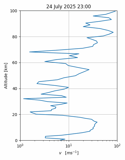
Figure: WAM forecast vertical wind profile.
Ready to test the Atmosphere API?
Create a trial account, browse the endpoint documentation, and start working with example upper-atmosphere datasets.